Coastal Classifications & Regulations
1. What kinds of coastal features are on or near the property, and what setbacks or regulations apply?
In addition to municipal zoning conditions, properties in coastal areas are subject to coastal zone management classifications that may carry building and permitting ramifications. These classifications are based on both the water the property abuts and characteristics of the shoreline on or near the property. Coastal or shoreline features such as coastal barriers, dunes, and wetlands have specific regulations and protections under the CRMC. These regulations include structural setbacks, buffers, and rules pertaining to construction and renovating or remodeling older structures. Depending on the property’s proximity to coastal features, there may be implications for new construction, home improvements, and structural alterations.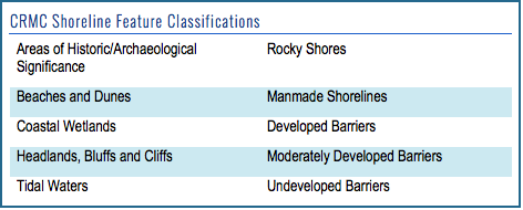

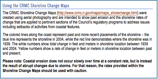
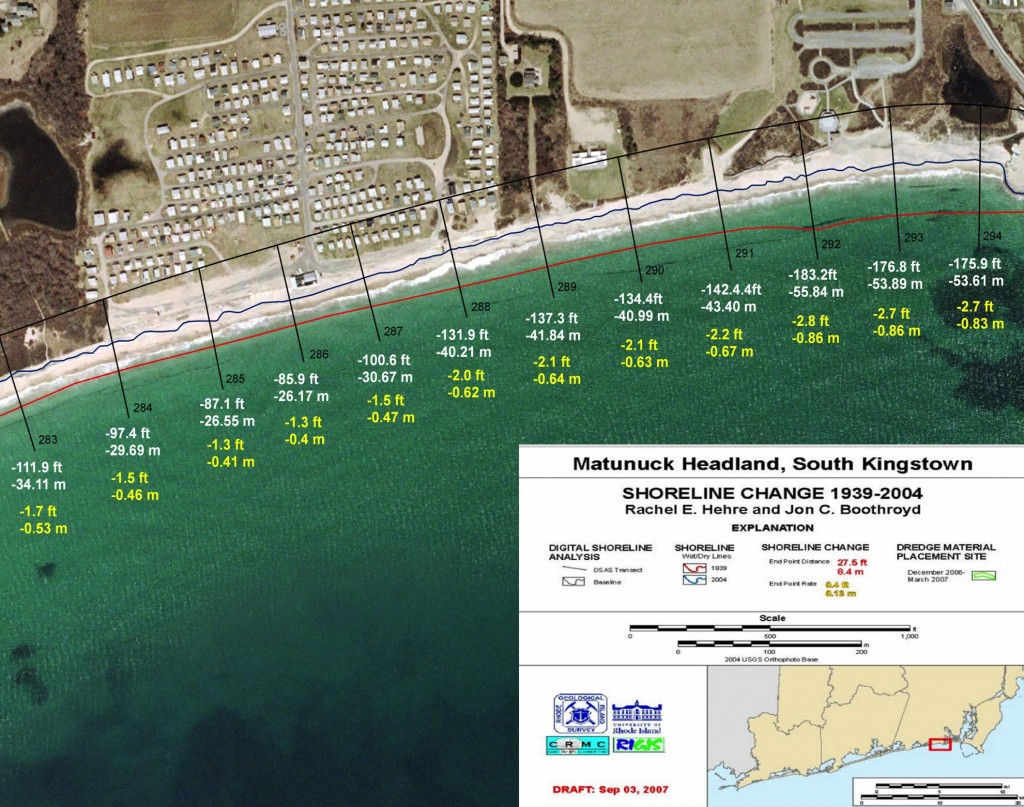
CRMC Shoreline Change Map for the Matunuck Headland in South Kingstown, R.I. Click for the full resolution.
2. Are there restrictions on the property due to the adjacent CRMC water classification?
All coastal waters in Rhode Island are categorized into six water types according to the characteristics of the adjacent shoreline, water use, and density of use. Conservation, recreation, transportation, and industrial activities all occur along the shore, and influence the shoreline policies and regulations based on water types. The six water type classifications, as designated by the CRMC, are: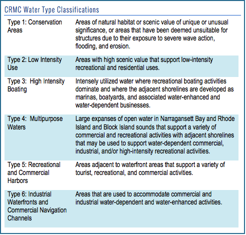 Why it matters: Though all areas along classified waters are subject to coastal zone management, properties located along certain water types may have more strict regulations for development. Some of the activities or structures that are regulated in the coastal area include:
Filling, removal, and grading along the shoreline Construction of residential or recreational structures, including docks Construction of public infrastructure Individual sewage disposal systems Installation of shoreline protection structures Beach nourishment (replenishment) Prohibition of new construction on undeveloped barriers
Identify the adjacent water type and find out more: For each coastal municipality, maps of water types and other shoreline classifications are available online. Information about restricted activities, prohibited activities, and permitting processes can be found in the CRMC regulations. Some coastal areas are governed by CRMC Special Area Management Plans, and as such, have area-specific regulations. To determine if the property is included under a Special Area Management Plan, visit the CRMC SAMP page.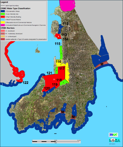
The CRMC Water Use map for the City of Newport, Rhode Island. The water use maps show the six different water types, or classifications, as determined by CRMC along Rhode Island’s coast. Maps for all of the coastal municipalities are at www.crmc.ri.gov/maps/maps_wateruse.html.
NEXT: FEMA Flood Zones & Insurance >>
This website has been prepared by the University of Rhode Island’s Coastal Resources Center and Rhode Island Sea Grant for the R.I. Coastal Resources Management Council as a guidance resource. It is not intended nor should be used to give any legal advice nor to supersede any state or federal statutory or regulatory language or interpretation of such language. This website refers the reader to various regulations and policies adopted by federal and state regulatory agencies; the reader is encouraged to review the specific regulation and policy.Rhode Island Coastal Property Guide Credits & Acknowledgements