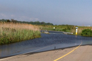
Northeast Particularly Vulnerable to Rising Seas

FROM THE RI COASTAL RESOURCES MANAGEMENT COUNCIL
May 16, 2017, WAKEFIELD – With new sea level rise projections from the National Oceanic and Atmospheric Administration showing the Northeast region, including Rhode Island, will be particularly hard-hit by 2100 – an additional 1 to 3 feet above the global projection – one might wonder why our region is so vulnerable.
According to a recent report, NOAA projects that sea levels in the Northeast (as well as some other areas in the country) will rise at a significantly faster rate than the global average (see the report here: https://tidesandcurrents.noaa.gov/publications/techrpt83_Global_and_Regional_SLR_Scenarios_for_the_US_final.pdf). The report gives a range of possible scenarios, from the low of 1 foot of sea level rise by 2100 to the worst-case scenario of 8.2 feet globally with an additional 0.98 feet to 3.28 feet for the New England region. This brings the maximum sea level rise in the Northeast to 11.5 feet by 2100.
So, why is this the case?
According to Bryan Oakley, Ph.D., assistant professor of Environmental Geoscience at Eastern Connecticut State University, and a frequent partner in CRMC regulatory and planning efforts, it’s due to two major factors: a reduction in velocity of the Gulf Stream circulation patterns in the northeast; and changes to the gravitational attraction of the large ice sheets of Greenland and the Antarctic.
“Historic Gulf Stream circulation actually causes the elevation of ‘sea level’ to be higher offshore (at the Gulf Stream) and lower towards the coastline,” Oakley said, citing Salinger, 2012. However, the velocity of the Gulf Stream is slowing. “Picture a banked turn in a racetrack. As the circulation slows, this causes the slope to decrease, and as the water level goes down along the Gulf Stream, the water level will rise along the coast – two ends of a see-saw, so to speak.”
To a lesser extent in our region, the relaxing of the earth’s surface as the crust adjusts after the retreat and melting of the Laurentide Ice Sheet, a massive ice sheet that covered most of Canada and a large portion of the northern United States, is a factor. Relative sea level rise, he said, is a combination of eustatic sea level change, which refers to changes in the amount of water stored in the ocean, and local effects from ocean circulation, land subsidence, and the readjustment of water around the planet as the ice sheets change.
And in simple terms, the large ice sheets, because of their mass, draw water towards them through gravitational attraction. As Greenland loses ice mass due to melting from warmer temperatures, the water once attracted to that ice sheet is redistributed, largely into the southern hemisphere, Oakley said. This actually lowers sea level locally. As the Antarctic loses mass, however, that water is redistributed on a path that acts as a bulls-eye on the mid-Atlantic and Northeast. These factors combined mean a possible additional 1 to 3 feet of sea level rise for our region, in addition to the global average projections.
According to Dr. John King, professor of Oceanography at the University of Rhode Island’s School of Oceanography, another key factor is that cooler water in the North Atlantic deep water acts like a vacuum, attracting water and literally sucking it offshore. If this natural process slows because of increasing ocean water temperatures, sea levels rise in New England.
Janet Freedman, CRMC’s coastal geologist, reiterates this by noting that seas are not actually level. In some places the ocean is a little higher and in some places, a little lower than the global average. Unfortunately, the northeast U.S. is one of the places that will see higher than average rates of change due to ocean dynamics, gravitational forces, and land subsidence, making adaptation to sea level rise all the more difficult here in Rhode Island.

“Currently, about six million Americans live within about six feet of the sea level, and they are potentially vulnerable to permanent flooding in this century,” said Robert E. Kopp, an associate professor at Rutgers University’s Department of Earth and Planetary Science, who coauthored the NOAA report. “Considering possible levels of sea level rise and their consequences is crucial to risk management.”
In Rhode Island, there are approximately 7,000 people living within the 7-foot sea level rise inundation zone, according to a R.I. Statewide Planning report, available at: http://www.planning.ri.gov/planning-areas/climate-change/sea-level-rise.php